I got up at 6:00, left the apartment at 6:30, bought some quick grub in my favorite breakfast place and stopped in 家樂福 (yes, that’s Carrefour Jiālèfú) for a six-pack of egg-flavored soy milk. Then youbike to 八德 (Bade – I know, 八德 seems to mean literally Eight Germanies, but there is little sense in trying to translate Chinese place names verbatim), another youbike to 鶯歌 (Yingge) and one more over the 大漢溪 (Dahan river) to 三峽 (Sanxia).
From there I took a morning bus. 五寮尖 (Wuliaojian) is served only by 807 and F627. There is F628 as well, but it plies the eastern bank of 三峽溪 (Sanxia river) and as there is no bridge to get to the other side, it was virtually useless for me. It’s Sunday so there is one service fewer for 807 (5 daily instead of the usual weekday 6) and F627 goes only four times a day. The 9:30 bus is weekdays-only, so my choice was either 8:30 or 11:00. But since the 五寮尖山 (Wuliaojian mountain) hike is a full-day endeavor, I had settled for 8:30.
An uneventful ride disgorged me barely half-an-hour later at the trailhead, already swarming with people. I availed myself of services of the world-renown 玉里商店 (Yuli store) and tried 太陽餅 (suncake) for the first time in my life.
Not bad, considering the bland ingredients that go into making it.
I set out at 9 sharp past the tourists who were dithering on the spot, preferring talking to the actual hiking, and up the trail. From the beginning it’s not really a climb but for one spot:

Technically, the route would be called scramble:


Everyone was cheerful and there was more than a fair share of Taiwanese retirees. Each of the trailgoers impeccably dressed in the latest fashionable hiking outfits save for the Westerners:

I have lived in Asia for far too long, so I respect the customs and dress like the locals do – long pants.
The views are alright, the hike is adequately adventurous and exciting, but definitely not dangerous as I have seen grandmas scaling the crags and rocky outcrops along with young couples.
While in Europe we have car-based traffic jams (something I almost never see in Taiwan, thanks to majority of the populace resorting to motorcycles), the only traffic jams one encounters here are people-based:

One reason being Taiwan is so densely populated, the other – and more important at that – is the number of bottlenecks on the trail (where only one person can climb up or down). Luckily, the route is circuitous and the recommended direction is clearly marked (albeit not enforced):

Soon we reached the ridge:


And with it, the best views so far:

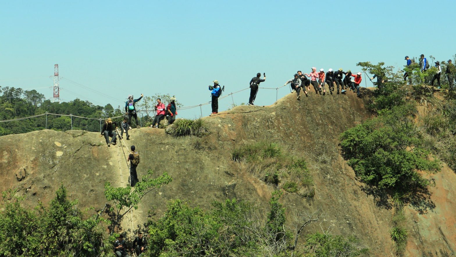
On and on it went until we hit a snag in the road – a massive people jam:

There was a daunting cliff-face to scale:

Though these guys appeared to be having some seriously good time waiting it out on the cliff:

I have to say from this point on climbing got more serious:

However, tough luck for the faint of the heart; it’s quite difficult to turn back from here.
It was elevenish and no point standing in line, so I whipped out my store of rolled oats, mixed it with the soymilk purchased in the morning, and enjoyed some sunshine with views over most of Taipei in the fleeting background disappearing in hazy smog:

After a short break, when I looked over my shoulder I noticed the queue had advanced forward but grew back equally. So I joined it at roughly about the same place I had deserted some 10 minutes before. The cliff was a serious bottle-neck, but even this infinitely cute Shiba-Inu named Jojo managed it:

And dogs are emphatically not good climbers!

Next, it was a short upward climb…

…to the 峭壁雄峰 (Craggy Peak)…

…from which 360° views can be had (and enjoyed):

However, after a short descent back the climb continued, as we still hadn’t reached 五寮尖山. With its 639m it’s not terribly high, but as for climbing this is definitely the toughest part. From the sheer cliff-face to a junction just under the peak.


While on the slow stop-and-go interminable march on the jam-packed trail I met (and chatted with) Samuel and other guys from his group:

Once we reached the junction (a favorite stopover place for larger groups), it changed into a regular hike. In a very short while we found ourselves at the highest point of the day:

3D summit picture and a shoutout to Samuel:

The views from the top are stunning and yes, you can indeed see Taipei 101!
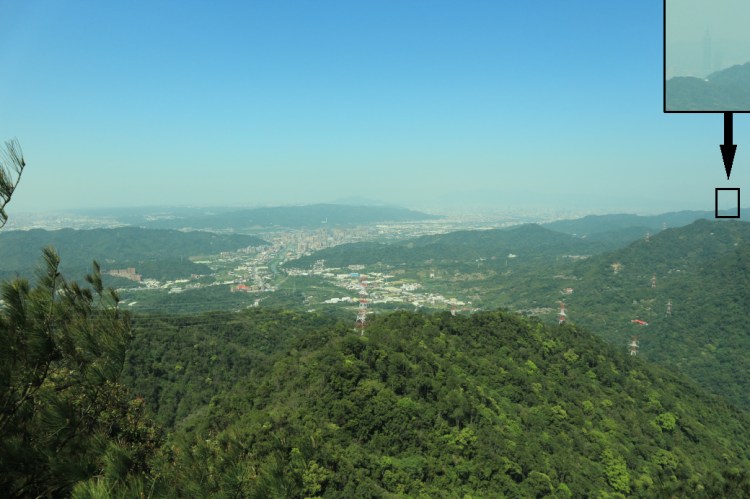 If you’re on good terms with the weather gods, that is.
We quickly descended via another side-trail but I lost contact with Samuel’s group at the junction – the very same we had passed through on our way up. That proved to be fortunate, however, as I had intended to take the full recommended circuit (in bold red on the map), not the shortest route down. So back up again to the summit, but not before I dined again. A couple minutes spent on top were followed by an exciting ladder descent…


…and then a brisk hike back down. On this side of the trail there is actually zero climbing involved, so all I was left with was macrophotography. Snapping pictures of flowers…

…or spiders:

When I reached the road I met a Taiwanese from 新莊區 (Xinzhuang district) of 新北市 (New Taipei City). He wanted to talk to me in English but I could hardly understand him. Still, I stayed with him and we talked a bit. Don’t know how much he understood me, but in the end it was a good choice because he showed me a turn-off from the road where this abandoned building stood:

Once back at the trailhead I realized I must have just missed 807, with F627 scheduled in almost an hour. Damned! Well, I was contemplating hitch-hiking when someone just shouted at me from the other side of the road:
“Where are you going?”
“Sanxia.”
“Come on in.”
As they say, in Taiwan one hitch-hikes by feigning a half-confused look on one’s face. The guy actually turned out to be from where I live – 中歷 (Zhongli) but I don’t think he quite understood me. In any case, I still wanted to check out 三峽老街 (Sanxia old street – ‘old street’ is a kind of a main business street in pretty much every Taiwanese town) so I asked him to just drop me off 在三峡市中心 (in Sanxia downtown).

Boy was it worth it! There was a group of guys right next to the 興隆宮媽祖廟 (Xinglong Gong Mazu Temple) performing with some sort of traditional Chinese spinning tops, I suppose.
But the real highlight was this guy making some traditional Chinese Taiwanese treats:

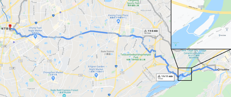
I have no idea how it’s called or where to get it, however, it’s incredibly tasty. Unfortunately, by the time I finished watching him making it the people in the line in front of me had bought out all that was left and the master chef left for his shack, probably to prepare ingredients for another batch. I didn’t know how long it would take and was hungry enough to decide it’s getting too late. So I grabbed some 冷面 (cold noodles) from 全家 (Family Mart), and then youbike back to 中壢.
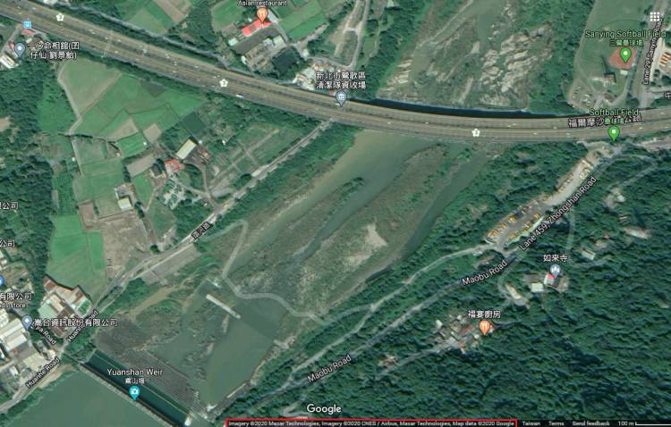
Google maps showed me this route and I zoomed in on the portion with the river crossing:
Weird.
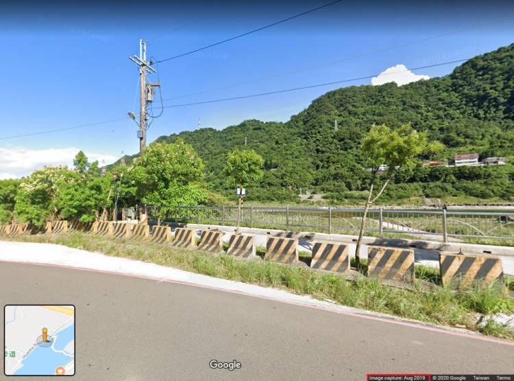
Who builds bridges like these – zig-zaggy? Ok, we have the benefit of Google Street view, so let’s have a closer look from the southern side, where the road skirts the edge of the river. Notice the date of the imagery:
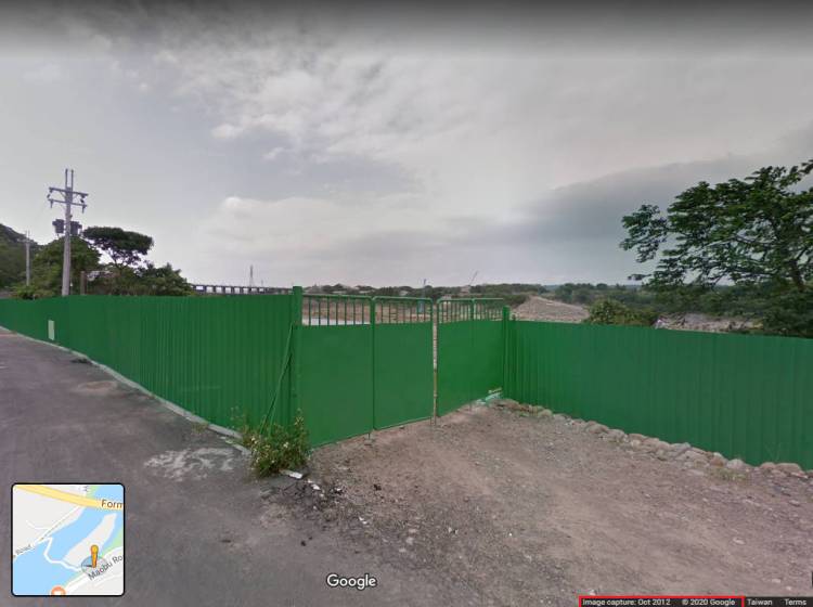
Almost 8 years old. At first I thought they may have built something, some bike path, in the intervening years. What about the other side, though? This is how it looks from the north:
No sign of any crossing whatsoever… Or even a building effort!
Just wanted to confirm from the satellite because – as you all surely are aware of – the Chinese Taiwanese can build stuff in a ridiculously short amount of time:
 The data from satellite is from this year.
Nothing.
Just a random white squiggly line haphazardly drawn over the river. Note that the neighboring 鳶山堰 (Yuanshan weir) straddling the river – which could be a real crossing, I mean, it literally bridges the river – does not deserve even a walking path on Google maps. Granted, there is zero evidence from Google Street View that pedestrians can actually cross it (off-limits from the south side, impenetrable from the north), it’s just left me wondering – who drew the bogus bridge? And most importantly, why? I could understand if Google mapmakers map suppliers would have mistakenly marked the weir as a crossing – a straight-line walking path. That would have made sense. But no, instead I was left with a nondescript white winding… something, that even aspires to be a road, not just a bicycle path.
Of course, it wouldn’t be me if I didn’t want to explore it. And sure enough, my theory was confirmed. There is nothing of any sort of crossing. From what I was able to gather – and Google Maps has been very instructive in my efforts – it used to be a makeshift river crossing for construction vehicles, remnant of which appears on the map as an artifact. Imagine you’re led to this on your youbike and then stumped, having to figure out how to cross the river some place else… not terribly pleasant.
It was funny. As I advanced in Google Street View, the capture date changed continuously from July 2019 to September 2015 to October 2012, pretty much travelling back in time. Nowadays, the area is well taken care of – a short bicycle path from nowhere to nowhere. But just a few years ago it used to be a massive dump overgrown with jungle.
So I returned to 鶯歌 (Yingge) over the car bridge, which does not even permit motorbikes (let alone bicycles) but because the separate bicycle/motorcycle bridge lane is under construction, the regular bridge is full of motorbike traffic and the police officer at the foot of the bridge didn’t but blink when I passed by him.
Then another youbike on to 八德 (Bade) with some incredibly beautiful designer apartment blocks:

There I bumped into a non-cooperating youbike bicycle stands that kept telling me I had to register my easyCard (as if it never had been). Usually, when I get random error codes I do what most customer service advises: Wait a bit. If that does not work I do what technical support specialists would recommend: Try it on another one. I kept getting the weird error #1 code, which basically means – you have not registered yet. So I attempted to follow what the bicycle stands had been telling me all this time and went through the registration. The kiosk was a bit lazy at first accepting my card but eventually told me what I had known all along – that my card is registered. This seemed to somehow reset the card and I could rent another youbike without any problem so I got all the way back home to 中壢 (Zhongli).
